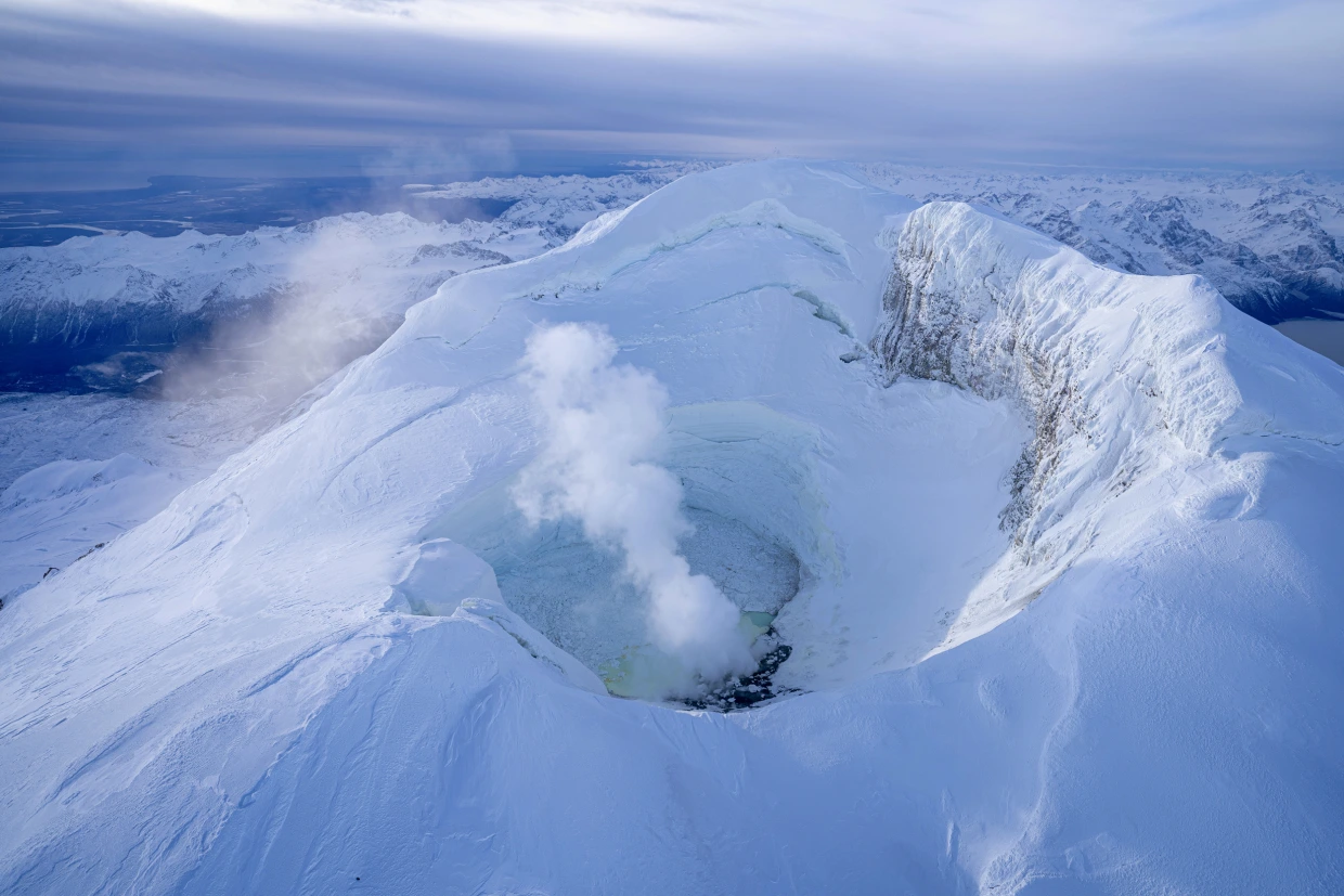
Signs of Mount Spurr’s Stirring
130 kilometers west of Anchorage, Mount Spurr—a silent giant since its 1992 eruption—is now stirring beneath the surface. As a geologist who’s worked in Alaska’s backcountry, I’ve felt that primal unease when volcanoes awaken. The Alaska Volcano Observatory (AVO) confirmed on June 26–27, 2025, that daily volcano-tectonic earthquakes are happening under its summit. These small quakes might seem minor, but their alarmingly constant rhythm signals unrest. Today, scientists track trembling signals—faint yet persistent, like a heartbeat accelerating underground. Each quake chips away at stability, cracking rock and forming potential pathways for magma to rise.
Science Behind the Swarms
Volcano-tectonic quakes differ from common earthquakes—they’re direct signals of magma forcing through rock layers. AVO’s seismic sensors record every fracture, mapping swarm clusters centered beneath the volcano. From my fieldwork, I know this pattern points to magma intrusion, not tectonic plate movement. GPS detects ground deformation: bulging or sinking areas reveal accumulation zones. Satellites monitor thermal anomalies, indicating rising heat levels near surface vents. When tremor frequency spikes or ground swells rapidly, scientists cross-reference data to confirm real risk. This multi-pronged monitoring is our critical safety net.
Immediate Threats to Life and Infrastructure
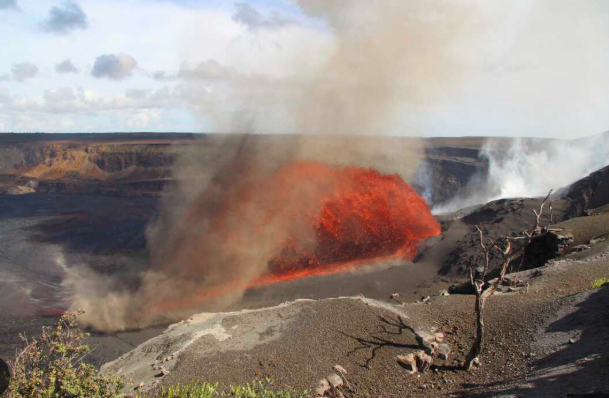
If magma breaches the surface, ash clouds could hit Anchorage International Airport in minutes—no speculation, just hard science. The Aviation Color Code is Yellow, meaning unrest is escalating. Jets flying through ash risk engine failure: turbine wear, flameout, and reduced visibility. Recall December 1992, when Spurr’s eruption sending ash 10 kilometers high darkening Anchorage. Photos show gray skies, dust-covered streets, and ashfall like a distant asteroid strike. Lahars—slurry-like volcanic mudflows—could sweep lethal volumes through glacier-fed channels, threatening Palmer, Wasilla, and smaller villages. Ash exposure affects air quality, making respiratory systems bear the brunt.
Emergency Readiness in the Last Frontier
Local authorities in Mat-Su Borough and Anchorage Office of Emergency Management are coordinating drills. Sandbags, masks, and clean-up gear sit pre-positioned at key locations. Schools have briefed families on evacuation procedures; businesses practice rapid closure. As someone who’s weathered Alaskan emergencies, I stress: Understanding hazard zones is non-negotiable. Plans anticipate ash, lahar-triggered roadblocks, and power line threats. Sirens, text alerts, and community apps will reach residents instantly. Being prepared isn’t panic—it’s responsible readiness.
Critical Warning Signs Ahead
Watch for seismic spikes—a jump to mid-to-high magnitude quakes suggests fractures reaching critical levels. Ground deformation hikes of centimeters signal magma arriving near the surface. Gas emissions (sudden CO₂/SO₂ spikes from fumaroles) or thermal anomalies (steam bursts near vents) mean fresh magma degassing. AVO monitors signals in tandem, ready to escalate alerts from Yellow to Orange or Red. Today’s Yellow could become Orange tomorrow—triggering full evacuation.
Regional Impact and Historical Echoes
A moderate explosive eruption might create a 5–10 km ash plume, spreading fallout hundreds kilometers downwind. Ash damages crops, contaminates water, and disrupts ecosystems. Lahars would rush valley corridors with mud, rock, and ice, washing roads and crippling infrastructure. Worst-case estimates predict airport shutdown, regional isolation, and cleanup stretching weeks. Commuters delayed, flights cancelled, and businesses shut down—mirroring 1992’s disruption.
Urgent Steps for Alaskans
If you live here: listen to local alerts, keep masks/ water stored, and know evacuation routes. Monitor AVO’s public data: real-time quake charts, ground deformation trends, and satellite scans. Subscribe to The Story Vault for seismic updates. This science isn’t abstract—it’s what keeps communities ahead of disaster.